
Polar Orbits
by Thomas Steinholz and Andrew Davis
by Thomas Steinholz and Andrew Davis
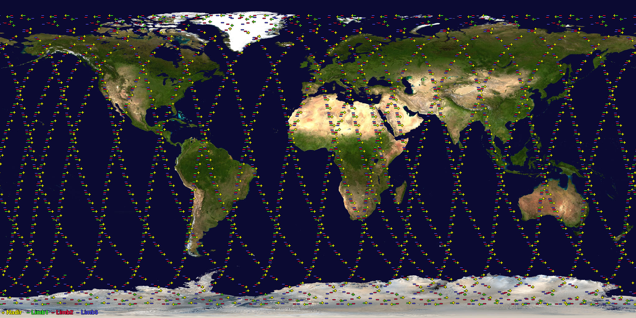
Polar Orbits are orbits that align with the earth's (north and south) poles which means a perfect polar orbit would have and inclination of 90 degrees. Their altitudes range from 700 - 800 km high with orbital periods of 98 - 102 minutes. These orbits are virtually every part of the earth.
The uses for satellites in polar orbit include measuring ozone concentration in the stratosphere, measuring temperatures in the atmosphere. Polar Orbits cross each latitude at about the same time every day which makes the satellites very good for regular data collection.
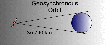
Satellites in geosynchronous orbits circle the Earth at the same rate as the Earth spins. Since the Earth takes 23 hours, 56 minutes, and 4.09 seconds to make one full revolution; the altitude of the satalities orbit based on Kepler's Laws of Planetary Motion, would be about 35,790 km up from the equator.
The purpose of these orbits are to center a satellite in almost a full hemisphere of the Earth. This is usefull for studying large scale phenomenon like hurricanes/cyclones, as well as communication. A downside to using geosynchronous polar orbits is the fact that the satalities need to be so far away thus gaining latency and lowering resolution.
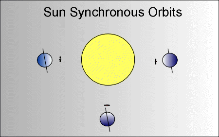
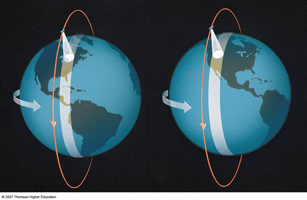
Sun Synchronous Orbits allow a satellite to pass over a certain point on the earth at the same time of every day. Since there are 365 days in a year and 360 degrees in a circle, the orbit changes about one degree per day to stay synchronous. The altitude of these orbits are around 700 - 800 km high and will either precede or recede based on the earth's bulges.
Since Sun Synchronous Orbits are constantly in the sun, satellites that require a constant amount of sunlight will use this orbit. A satellite might need a constant source of sunlight for their solar panels thus powering the satellite, as well as a satellite that takes pictures of the earth thus using the sun for lighting in their pictures. You can also map the orbit to be opposite of the earth (in darkness) for uses like longwave radiation collection which would be best in the dark.
Polar Orbiting Satellites. Retrieved April 20, 2016, from http://www.phy6.org/Education/wlopolar.html
Basics of Space Flight: Orbital Mechanics. Retrieved April 20, 2016, from http://www.braeunig.us/space/orbmech.htm
Polar Orbiting Satellites: The POES program. Retrieved April 20, 2016, from http://ww2010.atmos.uiuc.edu/(Gh)/guides/rs/sat/poes/home.rxml
Types of Orbits. Retrieved April 20, 2016, from http://marine.rutgers.edu/cool/education/class/paul/orbits2.html
Retrieved April 20, 2016 from http://apollo.lsc.vsc.edu/classes/met130/notes/chapter5/graphics/polar_orbit_schem.jpg
Retrieved April 20, 2016 from https://eosweb.larc.nasa.gov/guide/tes/images/example_global_survey.jpg
NOAA's Geostationary and Polar-Orbiting Weather Satellites. Retrieved April 24, 2016, from http://noaasis.noaa.gov/NOAASIS/ml/genlsatl.html
Satellite Orbits. Retrieved April 24, 2016, from http://scool.larc.nasa.gov/orbits.html
Polar Orbiting Satellites. (n.d.). Retrieved April 24, 2016, from http://tornado.sfsu.edu/geosciences/classes/m407_707/Monteverdi/Satellite/PolarOrbiter/Polar_Orbits.html